
On Walkabout: Aerial Pictures of Oahu
I have flown in and out of the Hawaiian Island of Oahu a number of times which has given me the opportunity to take some pictures from the air of this beautiful island. I would really like one day to take a helicopter tour of the island, but my view from the commercial airplanes will have to do for now. Here is a map of Oahu to orient people unfamiliar with the island with the below pictures:

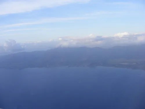
Note that the below pictures are not all from the same flight, but instead from different flights I took into Oahu. The first picture below is of Ka’ena Point which is the short peninsula that sticks out into the ocean on the northwest side of the island:

As the plane traveled south down the westward side of the island the Wai’anae Mountains came into view:
Mt. Ka’ala at 4,020 feet in altitude is the highest peak in these mountains as well as being the highest peak in all of Oahu. This western side of the island is also known as the Leeward side due to the lack of rain that falls on this side of the island:

The Leeward side of the island is also known as the part of Oahu where the highest concentration of native Hawaiians live:

Here is a view of the southwestern side of the island as the airplane prepares to approach Honolulu:

Once again the lower slopes of the Wai’anae Mountains came into view:

Here is a picture of the airplane flying low over the southwestern portion of the island that continues to grow into a residential community:

This next picture shows Pearl Harbor out in the distance:

Here is a closer look at Pearl Harbor which really is a must see location for anyone visiting Oahu:

Unfortunately I haven’t been able to ever get a shot of Honolulu from the airplane due to the fact that the flight attendants tell everyone to turn off their electronic devices. However, I did get this shot of Honolulu from up above at the summit of Diamond Head Crater:

The above picture shows how the residential neighborhoods of Oahu snake up the side of the Ko’olau Mountains. This next picture is a beautiful shot of Honolulu and its famous Waikiki Beach:

That is all for my aerial photos of Oahu, but I look forward to taking more pictures of this beautiful island if the opportunity presents itself the next time I fly into the paradise that is Hawaii.
Share this:

About The Author
Dobbs
I am a avid hiker with a love for travel and the outdoors. I currently call the Evergreen State of Washington my home.
